
Late Evening Arrival
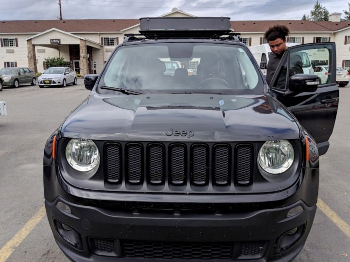
It was already late evening when we arrived in Juneau. The first order of business was picking up the Jeep Renegade Tristan had rented via Turo.
After this, we stopped at Safeway to get gas, water and food. We then went to meet Leslie at the Airbnb I had booked for the week.

It was called Forest Haven and if you ever decide to visit Juneau, I strongly recommend trying to book here first. Not only was this a fraction of the cost of booking a hotel, but it was also a fraction of the cost of other Airbnb options. This sign pictured above was waiting for us when we arrived, as was Leslie!
We were very much impressed with the room itself, as we had our own private entrance, bedroom with two beds, our own bathroom and a kitchenette that was already stocked with food. I’m talking fancy cheeses, homemade yoghurt, water, juices, boiled eggs, and every tea you could think of!
We planned on heading back into town but were ultimately so tired at this point—having been to four airports and three time-zones—that we settled down to rest up for what was described as a “moderate hike” to Mendenhall Glacier.
Early Rising
The following morning, we woke at around 9AM and readied ourselves to be out the door. To Tristan’s surprise, I offered to drive. I’m glad I did because the Jeep Renegade was a car I had considered buying, but no more! The drive to the West Glacier Trail head was only about 10 miles from our rooms and very easy to find.

Immediately after parking the Jeep we were met with this view. Looking back at this picture, I now notice, that was the glacier just beneath the mountain tops. But, having never seen one before, we didn’t recognise it from the distance.
We were excited for this quick 3.4 mile hike to the famous Mendenhall Glacier, but let me tell you now, Tristan and I were in for a rude awakening. Had we taken the warnings more seriously, we would have known what we were truly in for.


This trail beat Tower Arches at Arches National Park as the hardest trail I have ever done—and it sure as English rain was not 3.4 miles! But we get ahead of ourselves…
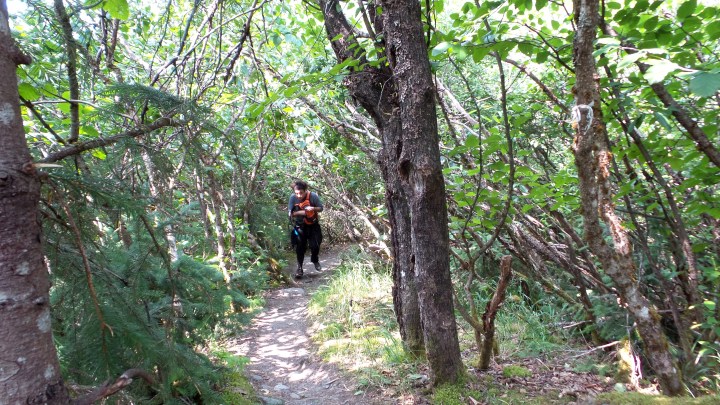
A Green Beginning

Like in Sitka, we were very surprised by how green everything was in Alaska! I mean the greenery in Alaska put even Georgia to shame. It was the complete opposite of anything I had ever imagined, and hard as this was, it is also the most beautiful hike I have ever completed in my entire life—even if it almost killed me in the process…


Look how clear and blue the water is! And just in case you’re wondering if the water was cold, the answer is yes! But, it was not unbearable. I stuck a hand in there and didn’t lose any fingers to frostbite. The temperature itself that day was in the 70s. Yes, very warm for Alaska.


As we continued along the trail, we noticed a lot of hikers rushing along. Tristan and I laughed at them. Poor fools! Did they not realise the trail was short and that we had plenty of time to stop and smell the greenery?

Well, while they sped on, we stopped to enjoy the shallow streams gurgling over rocks.


Even more impressive than these were the beautiful little waterfalls.


So, of course we dilly-dallied and splashed in the puddles, like children with nothing better to do.

We didn’t move on until we were good and ready! By then, we were sure we would still make good time and were only too excited to see what lay ahead. Would there be more waterfalls? Would the glacier be right around the bend? Would the flies on the trail ever go away?

We made our way up this eroding hill, all the while keeping an eye out for that right turn that was supposed to mark the poorly maintained trail to see the glacier. We chose it because the locals we spoke to said it offered a much better view of the glacier than the more popular, better maintained trail to the left.
The Ice Limits

We knew we had found the path when we came across this cairn with the 1942 Ice Limit. At this point, we were only about 2.5 miles at most into the trail. And let me tell you now, the trail turned out to be around 5.2 – 5.5 miles each way! Aside from this being way longer than we planned for, take a moment to realise how far the glacier has receded since 1942. We would come across many more markers like this along this trail.

As for being poorly maintained, it wasn’t too bad. Also, these brightly coloured ties really helped us find our way. They were in various colours like pink, orange and red—basically any colour that would stand out as unusual in Alaska. Even better, these appeared all the way to the glacier, as even when you can see Mendenhall Glacier, it’s easy to lose your way hiking along the rocky slope.

At some point, we lost sight of the brightly coloured plastic ribbons and came out here. Try as we might, we could not find a way around the lake or through the mud which separated us from going further inland.
Disheartened, we turned back, but as we did, I saw another brightly coloured ribbon fluttering in the breeze to our right. Off we trotted into the woods along a path that is actually quite easy to miss!

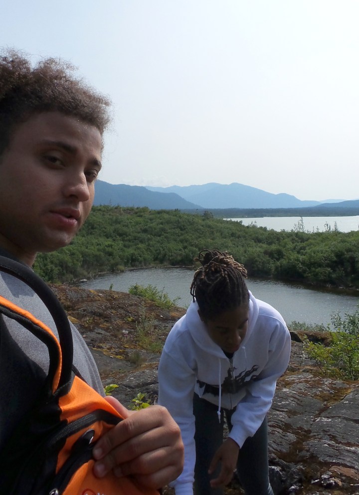
That took us to this cairn, and no, we were still nowhere near the glacier. In fact, at this point, we could not even see it. We were also tired and hungry by then, so we sat down to snack and drink some water, while looking out at this beautiful lake.

Once we were rested and watered and fed, we resumed what would now become an uphill climb over a rocky precipice. Some of it was no uphill hike, but an actual climb! It was too dangerous to take the cameras out at that point, so unfortunately, I have no pictures of it besides this 1984 marker for where the glacier once stood.

The 1985 marker stood at the top of that climb.

That water body pictured behind the cairn above is the lake we had seen when we first lost our way. The picture below is where we had sat down to snack.

See those people in the picture below, by the cairn? That was how far we climbed up! You can barely make them out.

At this point, we still couldn’t see the glacier and had a bit more climbing to do. Another ten or so minutes though and we got our first real glimpse of it that we could actually recognise.

Another ten minutes and I could take a selfie with Monsieur Mendenhall. At this point, we were still a mile and a half or so away. Don’t be fooled by how close it looks in the picture!

We also had a good view of Nugget Falls, which marks another trail to the glacier. Many people kayak from the shore, which is a much easier route than the way we came.

And behold, another cairn.

After a lot of climbing up and down the rocky trail, we made it to the 2000 marker. 
The last marker was for 2011, which was still some distance from where the glacier stands today. Global warming and climate change is fake news, eh?
Meet Mendenhall

Mendenhall Glacier was a lot smaller than we had expected, even with the markers dropping hints along the way. It was also dirtier than we expected, thanks to hikers who took to the ice and further chipped away at it. In any case, I am glad I saw at least one glacier before they melt into oblivion.


Heading Back


As is often the case, the hike back seemed shorter than the hike to the glacier, and we were only too glad to emerge from the forest to see the Jeep waiting. We were exhausted, but that was short-lived.
We drove home so we could shower and head out to eat. After dinner, we took a ride on the Mount Roberts Tram. But, that is a story for another day—specifically next Friday. See you, then!
Cost breakdown for this trip:
- Round trip from Atlanta to Alaska: $711.61
- Round trip from Las Vegas to Alaska: $579.80 (Tristan paid for his flight)
- Airbnb Booking: $317.99
- Turo Car Rental: ~$347.35 (Tristan paid for the car rental)
Thus, the entire trip cost me $1,029.60 and cost Tristan $927.15. Together, we shared a total cost of $1,956.75. This was our most expensive trip to date and worth every penny!
21 thoughts on “Hiking in Alaska: The West Glacier Trail to Mendenhall Glacier in Juneau”